Hertziana Studies in Art History
Hertziana Studies in Art History is the first digitally-born publication series at Bibliotheca Hertziana – Max Plank Institute for Art History. Its goal is to provide the ideal environment for the institute's scientific publications that gain the most from the native digital format through web links, semantic annotations, interactive content and open linked data connections (to name a few). At the moment there is no option for direct submissions for publication, given that all proceedings are curated directly by the coordinators of conferences and workshops, but there might be calls for papers related to specific research areas in the future.
Vol. 3 - 2024
From Hype to Reality: Artificial Intelligence in the Study of Art and Culture
Edited by Eva Cetinić & Darío Negueruela del Castillo
ISBN: 978-3-949381-02-7 DOI: 10.48431/hsah.03
As technologies related to AI (artificial intelligence) are progressing intensively, the hype surrounding the acronym 'AI' have become an evolving but persistent phenomenon. However, the reality of working with AI technologies often remains distant from its idealized representation and involves many constraints and difficulties, which become particularly obvious in interdisciplinary research contexts. In recent years, the critical discourse on AI has also gained momentum, partly due to the increasing interest of scholars in the arts and humanities in exploring AI technologies and the implications of their widespread integration. This collection comprises short articles from scholars who undertook the challenging task of examining various aspects of AI in the context of art and culture. It combines approaches that explore how AI technologies can be applied to study art and culture, as well as how arts and humanities-based theories and methodologies contribute to contextualizing and critically assessing AI technologies. This volume consolidates contributions from scholars from diverse disciplines, including art history, media studies, philosophy, anthropology, digital humanities, and computer science. It offers a unique selection of insightful articles that provide valuable cross-disciplinary perspectives, fostering a deeper understanding of the dynamic intersection between AI, art, and culture.
Eva Cetinić
Introduction
Amanda Wasielewski
The Reification of Style in AI Image Generation
Nuria Rodríguez-Ortega
Exploring the Concept of Transduction to Interpret AI-Generated Images
Bokar N'Diaye
Stochastic Parrots in the Ancient City?
Dejan Grba
Incidental Reverberations: Poetic Similarities in AI Art
Arif Kornweitz
Inside the High-Dimensional White Cube
Dominik Vrabič Dežman
Interrogating the Deep Blue Sublime: Images of Artificial Intelligence in Public Media
Pepe Ballesteros Zapata
Evolving Methodologies: Computation in Art History
Valentine Bernasconi
Automated Body Pose Estimation on Painting: A Crisis of Uncertainty
Piera Riccio & Nuria Oliver
A Techno-Feminist Perspective on the Algorithmic Censorship of Artistic Nudity
Anne-Laure Oberson
Making Sense of AI Generated Images in the Process of Imagination
Vol. 2 - 2023
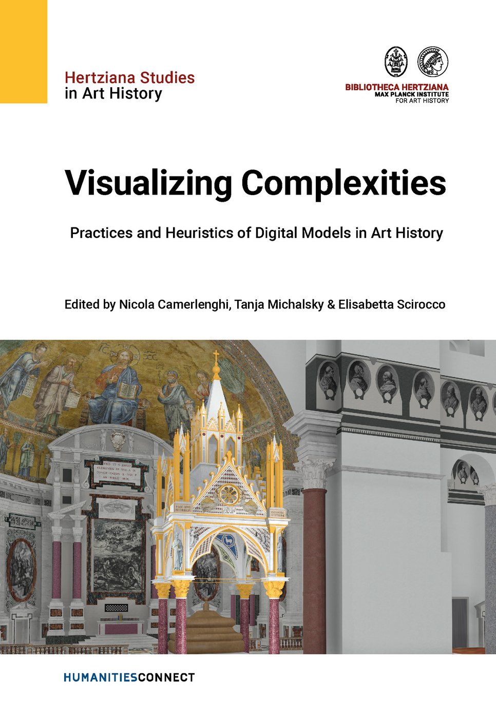
Visualizing Complexities. Practices and Heuristics of Digital Models in Art History
Edited by Nicola Camerlenghi, Tanja Michalsky & Elisabetta Scirocco
ISBN: 978-3-949381-01-0 DOI: 10.48431/hsah.02
Digital models help to visualize complexities heretofore unapproachable through more conventional methods of art history. The seductive qualities of these models—which tend to transcend those of words—are increasingly untempered by their digital and thus potentially alien nature. Modeling technologies—including, but not limited to, GIS, photogrammetry, laser scanning, VR, AR, or BIM—can assist not only in visualizing, but also in measuring, reconstructing and, thus, analyzing works of art and architecture. With the use of these tools come both challenges and opportunities. Furthermore, the interdisciplinarity of digital approaches invites diverse conventions, and as the media used for digital visualizations are adopted across disciplines and their hermeneutics contested, the resulting epistemes are naturally hybrid. The authors of this volume present and discuss their ongoing projects in art and architectural history involving 3D-modeling. The aim of this collection, stemming from a workshop held in December 2020 at the Bibliotheca Hertziana, is to pose some of the most pressing questions about the process of visualizing artistic complexities.
Nicola Camerlenghi, Tanja Michalsky & Elisabetta Scirocco
Visualizing Complexities. Practices and Heuristics of Digital Models in Art History
Giacomo Landeschi
What is a 3D Model and Why Do We Model? Some Reflections Built Upon Archaeological Case Studies
Angelica Federici
Visualizing Medieval Rome. The Basilica of Sant’Agnese fuori le mura
Giulia Bordi
Visualizing Medieval Rome. Digital Storytelling about the City and its Churches
Nicola Camerlenghi
Virtual St. Paul’s Basilica 2.0. Developing an Open Educational Resource
Fabrizio Nevola, Donal Cooper, Chiara Capulli & Luca Brunke
Bringing Together Geospatial Information, 3D Modeling, Experiential Learning and Research Data. The Ospedale degli Innocenti: A Case Study of the Florence 4D Project
Andrea Giordano & Paolo Borin
Visualizzare la complessità. Fondamenti BIM per il progetto Visualizing Cities
Ruggero Longo
Digitizing Cultural Heritage. Methodology, Potential, and Limits of the Palermo Royal Palace Project
Piotr Kuroczyński
Serious 3D in Art and Architectural History
Vol. 1 - 2022
Walking through history. An Interdisciplinary Approach to Flavio Biondo’s Spaces in the "Italia Illustrata“
Edited by Tanja Michalsky & Martin Thiering
ISBN: 978-3-7774-4069-9 DOI: 10.48431/hsah.0100
This volume presents the results on an ongoing research about the use of digital humanities methods for analyzing spatial meanings in Renaissance texts and maps, specifically focusing on Flavio Biondo’s Italia illustrata. The authors use computational and corpus-driven text and map analysis, as well as cognitive anthropology and gestalt theory, to identify and visualize spatial concepts encoded in historical maps and texts. They aim to discover sources and provide a cognitive map for readers by encoding information in a way that helps readers understand spatial information. The text also discusses the plurality of spaces and the changing perspectives of spatial concepts over time, particularly from the Renaissance to the digital age.
Tanja Michalsky & Martin Thiering
Walking through history. An Interdisciplinary Approach to Flavio Biondo’s Spaces in the “Italia Illustrata”
Günther Görz, Chiara Seidl & Martin Thiering
Linked Biondo: Generating and Processing Research Data Based on Geographical Feature Modeling
Kurt Guckelsberger & Klaus Geus
Measurements, Maps, and Other Source Material in Biondo’s Italia Illustrata: The Example of Latium
Kurt Guckelsberger
Two Great Maps of Italy – A Comparison
Marc Laureys
‘Illustrating’ Italy: Biondo’s Concept of Illustratio
Nathalie Bouloux
L'usage des cartes dans l'Itala Illustrata de Biondo Flavio
Martin Thiering & Raphael Berthele
Some Thoughts on a Spatial Language Analysis of Flavio Biondo’s Illustrated Italy
Kai-Florian Richter
The Description of Places in Biondo’s Italia Illustrata: Outlining a Quantitative Analysis of Their Granularity and Spatial Relationships
